
attraction · Granada
Mirador de la Magdalena
Andalucía 365 · Updated 18 July 2026
Our Verdict
“The Mirador de la Magdalena provides an essential, unvarnished look at how Guadix functions. While the climb is steep and the platform lacks facilities, the commanding view of whitewashed chimneys against the cathedral and the Sierra Nevada is the single best way to grasp the scale of this troglodyte city.”
Last verified: July 2026
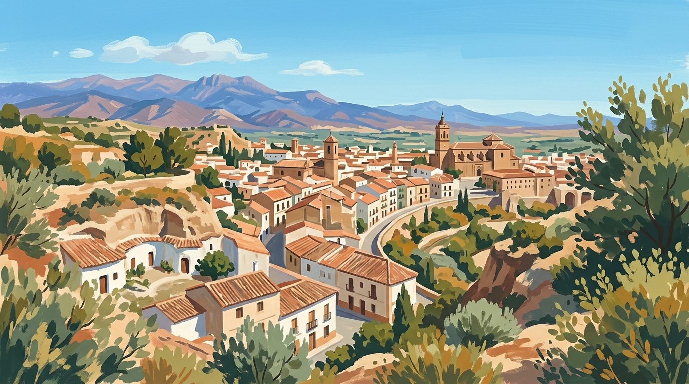
White chimneys protruding from raw, clay-coloured earth define the immediate foreground at the Mirador de la Magdalena. Located on the Cerro de la Magdalena, this elevated vantage point provides a stark visual summary of this unique corner of Andalucía. It frames the subterranean homes of the Barrio de las Cuevas against the monumental architecture of the historic city centre and the snow-capped ridges of the Sierra Nevada. The viewpoint offers an unvarnished look at a living neighbourhood, where daily life carries on beneath the surface of the hills, much as it has for generations.
Why It Matters
The surrounding region is home to one of the largest inhabited cave districts in Europe. While walking through the winding streets provides a close-up perspective of individual homes, it is difficult to grasp the true scale of the settlement without seeing it from above. The Mirador de la Magdalena solves this spatial puzzle. It illustrates how the troglodyte dwellings were carved directly into the soft clay hills, creating a sustainable living environment that naturally maintains a constant temperature throughout the year. The profound contrast between the rudimentary earthen mounds, the neatly whitewashed facades, and the towering silhouette of the central cathedral demonstrates centuries of architectural evolution and social division in a single sweeping glance.
What Visitors Actually See
From the paved viewing platform, the panorama is evenly split between natural geology and human engineering. In the immediate vicinity, a dense forest of white chimneys dots the undulating red terrain. These mark the ventilation shafts and kitchen flues of the cave houses operating below the surface. Many of these dwellings feature distinct, painted brick facades and small walled patios carved right into the rock face, surrounded by prickly pear cactus and dry brush.
Looking towards the historic core, the horizon is firmly anchored by the imposing mass of the cathedral, which rose over several centuries. Its complex blend of Gothic, Renaissance, and Baroque architectural styles stands in sharp relief against the rugged badlands. To the right, the Alcazaba, a reddish-brown Moorish fortress dating primarily to the eleventh century, claims the dominant ridge, serving as a permanent reminder of the strategic importance of this valley. On clear days, the distant peaks of the Sierra Nevada provide a dramatic, often snow-dusted backdrop to the south. As the sun drops in the late afternoon, the low light casts deep shadows across the ravines, turning the clay a rich ochre and highlighting the stark white of the residential chimneys.
A Candid Assessment
The Mirador de la Magdalena is arguably the strongest public viewpoint for capturing the relationship between the monumental centre and the subterranean district. It does not require a long trek into the wilderness, as it is fully integrated into the local residential fabric. However, it is fundamentally just a viewing platform. There are no facilities, shaded rest areas, or detailed informational plaques at the top. The experience depends entirely on the atmospheric light and the clarity of the sky. Visitors looking for a quick, impactful visual summary will be highly satisfied, but those expecting a curated or interactive attraction might find the visit brief.
Terrain and Accessibility
Reaching the viewpoint requires navigating the steep inclines of the cave district. Starting from the lower town near the cathedral, the walk typically follows Calle San Miguel and continues up paved residential streets such as Arco Mensafíes or Real de Santo Domingo. The route takes around fifteen to twenty minutes on foot and includes steep, occasionally uneven gradients. Because the streets are remarkably narrow and parking is severely limited among the caves, driving directly to the viewpoint is highly discouraged. Visitors should wear sensible walking shoes, as the smooth paved inclines can become slippery, especially after rain. The final viewing platform itself is paved and level, but it lacks dedicated seating or shelter from the intense summer sun.
How to Visit and Who It Suits
This public outdoor space is a natural addition to any walking route through the city. To verify current access conditions, check for temporary municipal works, or to download official town maps, consult the Guadix municipal website before your arrival.
The viewpoint best suits photographers, architecture enthusiasts, and independent travellers who appreciate dramatic, contrasting landscapes. It is less suitable for visitors with significant mobility issues due to the steep urban climb required to reach the summit. Late afternoon is the optimal time for a visit, as the softer light improves visibility across the basin and enhances the deep natural colours of the clay landscape, making the white chimneys stand out prominently.
Sensible Nearby Pairings
After surveying the landscape from above, descending into the Guadix cave district is the logical next step. A visit to the nearby Cueva-Museo allows visitors to understand the interior layout, the traditional furnishings, and the domestic history of the dwellings they have just seen from the elevated ridge. For those exploring further afield, the dramatic badlands geology extends throughout The Marquesado and Guadix, leading to other historic subterranean settlements like Purullena, where roadside pottery shops are carved directly into the high clay banks.
Nearby worth your time
A few well-placed stops for extending the day without turning it into a checklist.
Continue through The Marquesado & Guadix
Step back into the wider landscape with local guides, nearby places and the province overview.
Place guide · 7 min
Playa de Calahonda (Granada) Beach Guide
Playa de Calahonda in Granada offers deep, crystal-clear waters and a dramatic limestone cliff backdrop. This Blue Flag beach is a favourite for snorkelling and authentic Andalucían seafood.
Place guide · 7 min
A Guide to Playa de Salobreña on the Costa Tropical
Playa de Salobreña is a vast stretch of dark sand and clear water on the Costa Tropical, overlooked by a historic Moorish castle and dramatic cliffs.
Itinerary · 10 min
Two Days in Granada: A Step-by-Step Itinerary
Two days in Granada gives you just enough time to explore the Alhambra and lose yourself in the steep alleys of the Albaicín. This itinerary balances major monuments with the city's legendary free tapas culture.