
attraction · Almería
Cerro San Cristóbal
Andalucía 365 · Updated 18 July 2026
Our Verdict
“Cerro San Cristóbal offers the most commanding views in Almería, perfectly illustrating the sheer scale of the Alcazaba. Following a major municipal redevelopment, visitors can now explore the 11th-century walls and enjoy sweeping Mediterranean panoramas from accessible, landscaped terraces, making it an essential and atmospheric stop for history enthusiasts.”
Last verified: July 2026
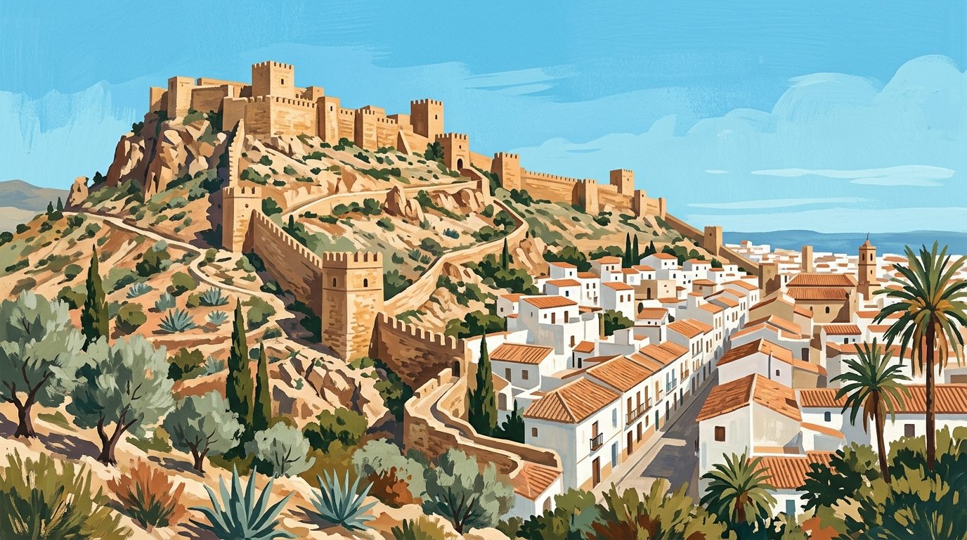
Standing on the exposed summit of Cerro San Cristóbal, visitors face the dramatic, plunging lines of the Muralla de Jayrán. This formidable historic curtain wall drops steeply into the Barranco de la Hoya ravine before climbing sharply to meet the colossal walls of the Alcazaba. Known during the Islamic era as Monte Laham, this rugged limestone hill was once the vital linchpin in the defensive network of the Taifa kingdom of Almería. Today, it serves as the premier vantage point over this corner of Andalucía, offering a perspective that physically connects the city's medieval military past with its modern Mediterranean coastline. The wind here is constant, carrying the scent of the nearby sea over ancient stone, providing a stark reminder of the strategic necessity of high ground. To stand on this summit is to understand exactly why generations of commanders chose to fortify this specific barren peak.
The Legacy of King Jayrán and the Templars
The northern side of the hill is defined by the jagged remains of the city walls, which originally enclosed the historic Musalla neighbourhood. Visitors can closely inspect a line of seven defensive towers that vividly illustrate the turbulent history of medieval Spain. Three of these structures feature the square footprint typical of Moorish military engineering, dating back to the reign of King Jayrán between the years 1012 and 1028. The remaining four semicircular towers were grafted onto the defences by the Knights Templar. Following a temporary Christian conquest led by Alfonso VII in 1147, these crusading knights transformed the high outpost into a fortified chapel. This architectural juxtaposition makes the hill an essential stop before visiting the main fortress, which you can explore further with our guide to the Alcazaba de Almería.
The Sacred Heart and the Cityscape
Crowning the very highest point of the hill is the Sagrado Corazón de Jesús. Carved from brilliant white Macael marble, this monument to the Sacred Heart was originally erected around 1930, was destroyed during the Spanish Civil War, and was completely restored in the year 2000. Standing on a massive stone pedestal, the statue acts as a modern beacon visible from almost every street in the city below. However, the true reward of the ascent is the complete panorama. Looking south, the urban layout unfolds toward the Alborán Sea, framed by the modern harbour and the distinctive, flat defensive roofline of the principal church, detailed in our guide to Almería Cathedral and the historic city centre. This viewpoint is the only place in the city where the relationship between the surrounding arid mountains, the coastal plain, and the deep blue sea becomes entirely clear.
A Candid Assessment
Following an extensive municipal redevelopment completed in late 2024, Cerro San Cristóbal has been transformed from a raw, unpolished peak into an accessible park and viewpoint. While Mediterranean winds still sweep across the exposed higher elevations, visitors can now make use of structured viewing terraces, resting areas, and landscaped pathways. These improvements make the ascent more manageable during the intensely hot summer months, though midday visits should still be approached with caution. The site remains a powerful historic vantage point. For those aiming to grasp the sheer scale of the Alcazaba and fully understand the medieval topography of Al-Andalus, the sweeping, unobstructed panoramas justify the climb. The experience strongly appeals to landscape photographers hunting for precise architectural alignments and military history enthusiasts tracking the evolution of siege defences.
Navigating the Ascent
Reaching the viewpoint has been greatly facilitated by recent urban regeneration projects. The traditional route on foot begins near Calle Pósito in the historic centre, where new stairways and ramps guide walkers up the hill. These modernised pathways incorporate designated shaded resting zones, allowing visitors to ascend at a comfortable pace. Alternatively, those driving can take the Camino de San Cristóbal, a winding road that leads to a dedicated parking area near the summit. While spaces can fill up during the popular late afternoon hours, the recent layout provides a more structured arrival point. The introduction of paved walkways and ramps has significantly improved accessibility across the site, opening up the primary viewing terraces to a wider range of visitors, including those with limited mobility, though the steepest historical sections remain challenging.
Practical Advice and Nearby Pairings
Since the viewpoint is an open-air public space, visitors are largely left to their own devices to explore the grounds. Always confirm live details, current access guidelines, or the schedule for guided municipal walking tours directly with the official Almería Tourism Board before setting out. Bring plenty of water and robust sun protection, as there are no commercial kiosks or cafes at the summit. The late afternoon is universally considered the best time to visit, as the setting sun casts a rich, golden light against the red sandstone of the Alcazaba, creating perfect conditions for photography. Once you have descended back into the urban grid, a sensible nearby pairing is to explore the wider cultural footprint of the province, which you can discover in our broader overview of Almería City. Finding a local bar in the old quarter for a traditional free tapa is an excellent way to conclude the walk.
Nearby worth your time
A few well-placed stops for extending the day without turning it into a checklist.
Continue through Almería City
Step back into the wider landscape with local guides, nearby places and the province overview.
Place guide · 8 min
A Local Guide to Playa de Mojácar: Sands, Spirits and Almerían Soul
Experience the diverse 17-kilometre coastline of Mojácar Playa, where volcanic sands meet clear waters and lively chiringuitos offer the perfect Almerían escape.
Place guide · 7 min
Playa de los Genoveses: A Guide to the Wild Heart of Cabo de Gata
Experience the untouched beauty of Playa de los Genoveses, a vast volcanic bay in Almería where golden sands meet shallow turquoise waters in a protected natural park.
Itinerary · 13 min
5 Days in Almería: City, Desert and Cabo de Gata
A realistic five-day driving itinerary through Almería province, balancing the historic capital, the cinematic Tabernas badlands, and the protected volcanic shores of Cabo de Gata.