
attraction · Huelva
Mirador de Aracena
Andalucía 365 · Updated 18 July 2026
Our Verdict
“This is the definitive viewpoint in northern Andalucía. While the steep, unshaded climb requires some physical effort, the reward is a complete spatial understanding of how a medieval frontier town evolved into the capital of a protected natural park. It is an essential orientation point.”
Last verified: July 2026
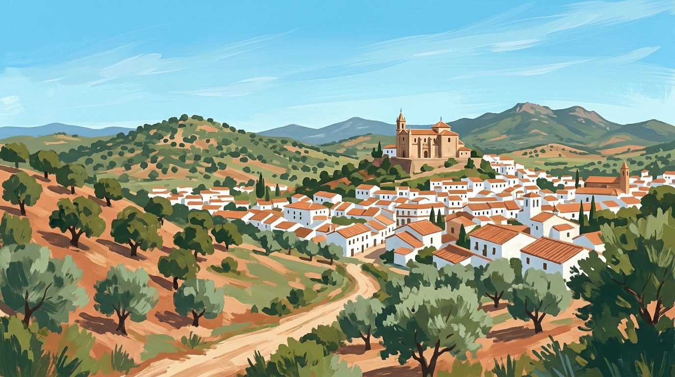
The crunch of uneven limestone cobbles gives way to the steady hum of wind sweeping across the Cerro del Castillo. Standing at the Mirador de Aracena, visitors are granted the definitive perspective of this historic town in the Huelva province. The vantage point offers an uninterrupted view across a sea of terracotta rooftops and whitewashed facades, sharply contrasted against the dark green ridges of the surrounding mountains. It serves as an essential first stop for anyone wishing to understand the layout of the town and appreciate the vast expanse of the traditional Mediterranean woodland that encircles it.
A Strategic Foothold
The mirador is inseparable from the summit it occupies. Cerro del Castillo is the highest point in the town and the site of its original settlement. During the medieval period, this hill held a vital strategic position. It was initially an Islamic fortress, a stronghold built to control the rugged terrain of Al-Andalus. Following the Christian conquest, it was rebuilt in the thirteenth century by Portuguese knights from the Order of the Hospital. Eventually, after border treaties settled regional disputes, it passed to the Kingdom of Castile. It then became a crucial node in the Banda Gallega, a fortified defensive line designed to protect the territory of Seville from Portuguese incursions and the rival military orders of the Knights Templar and Santiago. Standing at the lookout points today, the rationale behind this location is immediately obvious. It commands absolute visual control over the valleys, agricultural lands and the crucial passes through the mountains.
Scanning the Horizon
From this elevated terrace, the urban planning of the municipality unfolds like a physical map. The oldest quarters cascade directly down the slopes from the fortress walls, featuring narrow, irregular streets adapted to the severe gradient. These early streets reflect the origins of the town as a settlement huddled close to the castle for protection. Further down, the layout expands into the broader avenues and plazas of the modern town. You can clearly identify the Plaza Alta, which served as the administrative centre during the fifteenth and sixteenth centuries, complete with the Cabildo and historical parish buildings.
Looking towards the newer districts, the grand Renaissance bulk of the Parish Church of Nuestra Señora de la Asunción anchors the lower town. Beyond the final row of whitewashed houses, the urban environment abruptly gives way to the rolling hills of the Sierra de Aracena. These hills are covered in a dense, managed ecosystem of sweet chestnut, cork oak and holm oak trees, stretching towards the horizon. This is the dehesa, a traditional landscape where livestock roam freely beneath the tree canopy, forming the foundation of the famous Iberian ham industry of the region.
The Priory Church and Castle Ruins
The mirador wraps around two significant monuments, providing a dramatic foreground for landscape photography. The Iglesia Prioral de Nuestra Señora del Mayor Dolor sits at the edge of the viewpoint. This church features striking Mudéjar brickwork on its tower alongside prominent Gothic architectural elements. Adjacent to the church are the restored remnants of the thirteenth-century castle. Visitors can freely walk the exterior terraces, examine the remnants of the defensive walls and take in the shifting light across the valley. Accessing the restored interior of the fortress, which includes the old parade ground and the highest tower, requires an entrance fee.
The Verdict
This is the definitive viewpoint in northern Andalucía. While the steep, unshaded climb requires some physical effort, the reward is a complete spatial understanding of how a medieval frontier town evolved into the capital of a protected natural park. It is an essential orientation point.
Practical Advice for the Climb
Accessing the mirador involves a determined walk from the town centre. Pedestrians can follow the signposted paths leading up from the Plaza Alta or take the stepped route starting near the entrance to the underground caverns. The climb takes roughly 15 to 20 minutes at a steady pace, but the gradient is continuous and requires a reasonable level of fitness.
Bring a bottle of water, as there are no shops or refreshment kiosks once you reach the top of the castle hill. Photographers will find a wide-angle lens useful for capturing the sweeping landscape, while a standard zoom helps isolate the architectural details of the church tower against the sky. The late afternoon is particularly rewarding for a visit. As the sun begins to set, it casts a warm glow over the white buildings, heightens the textures of the distant mountains and provides excellent conditions for photography. Early morning is also highly recommended to avoid the severe midday heat, especially during the peak summer months. For the latest access policies regarding the ticketed castle interior, check the official Aracena tourism site.
Accessibility and Terrain
The ascent to the Cerro del Castillo involves a very steep gradient and uneven, centuries-old cobblestones. It is entirely unsuitable for wheelchair users or those with significant mobility issues. Visitors should wear sturdy, flat shoes with a dependable grip. The polished stones can become treacherous and slippery, particularly after rainfall or early in the morning when dew is present.
What to Do Next
It makes geographical sense to pair the climb with a descent into the Gruta de las Maravillas, the spectacular limestone cave system located directly beneath the castle hill. Afterwards, explore the culinary heritage of the lower town by walking the broader streets of Aracena, where you can sample regional Iberian pork products. To understand the reliance of the wider region on the oak forests visible from the summit, delve into our complete guide to exploring the Sierra de Aracena. Finally, active travellers inspired by the landscape can tackle the extensive network of routes detailed in our guide to hiking and walking in Huelva.
Nearby worth your time
A few well-placed stops for extending the day without turning it into a checklist.
Continue through Sierra de Aracena y Picos de Aroche
Step back into the wider landscape with local guides, nearby places and the province overview.
Place guide · 7 min
Playa de Castilla: The Wild Frontier of the Doñana Coastline
Playa de Castilla is a vast, 20-kilometre stretch of wild Atlantic coastline bordered by the spectacular orange cliffs of the Doñana National Park.
Place guide · 7 min
Playa de Isla Canela Beach Guide: Huelva Coastline
Playa de Isla Canela is a vast stretch of fine sand where the Guadiana River meets the Atlantic, famous for its shallow lagoons and family-friendly atmosphere.
Itinerary · 12 min
5 Days in Huelva: Atlantic Coast, Doñana and Sierra
A realistic five-day driving route through Huelva province, linking the maritime history of the capital with the tidal wetlands of Doñana and the chestnut forests of the Sierra de Aracena.