
attraction · Huelva
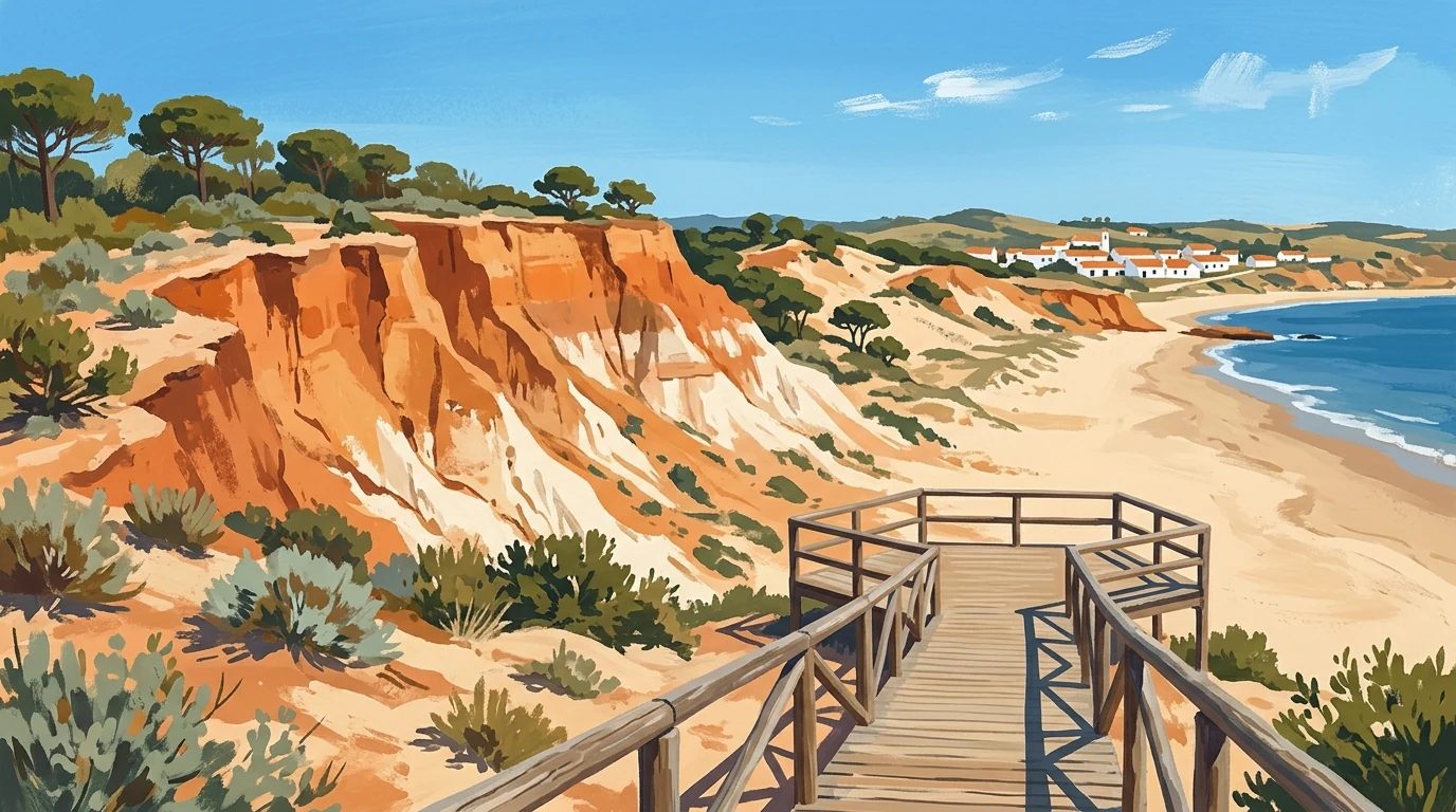
Monumento Natural Acantilado del Asperillo
Andalucía 365 · Updated 18 July 2026
Our Verdict
“A spectacular geological marvel, the Asperillo cliffs offer one of the most dramatic and unspoiled coastal walks in Andalusia.”
Last verified: July 2026
Rising dramatically from the Atlantic coast of Doñana National Park, the Monumento Natural Acantilado del Asperillo is a striking system of fossilised dunes. Located between the coastal towns of Matalascañas and Mazagón in Huelva, this towering wall of layered sand stretches across 12 hectares of wild, undeveloped shoreline. Visitors approach the cliffs via the Cuesta Maneli boardwalk, a scenic trail that winds through stabilised dunes and pine forests before revealing panoramic ocean views. The site is highly valued by geologists, nature enthusiasts and walkers seeking a pristine coastal landscape far removed from urban development. With its vivid strata of orange, ochre and black sands, the Asperillo offers a vivid record of the earth's natural history and a spectacular backdrop for a coastal hike.
Why It Matters
Considered one of the most unusual geomorphological formations on the Iberian Peninsula, the Asperillo cliffs are the result of eolian and alluvial sands accumulating over millennia. The oldest materials at the base of the cliffs are estimated to be between 14,000 and 15,000 years old. Over time, tectonic forces lifted these sedimentary layers more than 100 metres above sea level. Today, the relentless action of the Atlantic waves and coastal winds continues to shape the dunes, carving out deep gullies and exposing distinct bands of orange, white, ochre and black sand. The site also serves as a crucial habitat within the wider Doñana ecosystem, supporting threatened species such as the spur-thighed tortoise, Lataste's viper and the Iberian lynx.
What to See and Do
The Cuesta Maneli Boardwalk
The primary way to experience the Asperillo is by walking the Cuesta Maneli trail. This wooden boardwalk, which was rebuilt following a major wildfire in 2017, stretches for just over a kilometre through the coastal scrub. As you walk, you will see how the shifting sands have been stabilised by the roots of resilient plants. Look out for stone pines, junipers and the corema shrub, which produces a small white berry known locally as the pearl of the dunes. The trail culminates at a high viewpoint offering sweeping vistas of the Atlantic Ocean and the sheer drop of the fossil dunes.
The Fossil Dunes and Beach
From the viewpoint, a set of wooden stairs descends directly to the beach, allowing you to appreciate the scale of the cliffs from below. The cliff face itself is largely devoid of vegetation due to the harsh winds and steep gradient, leaving the geometric shapes and colourful strata fully exposed. Walking along the shoreline reveals the continuous erosion caused by the sea, with intricate gullies and undulating patterns carved into the sand. The beach here is entirely undeveloped, providing a quiet environment for walking, birdwatching or simply observing the natural architecture of the coast.
Planning Your Visit
Getting There
The Asperillo cliffs and the Cuesta Maneli trail are located on the A-494 road, which connects Mazagón and Matalascañas. The trailhead is clearly signposted and features a dedicated parking area just off the road. There is no direct public transport access to the start of the trail, so arriving by car or cycling along the El Asperillo cycle route are the most practical options.
How Long to Allow
The walk along the boardwalk takes around 30 minutes each way. However, you should allow at least two to three hours for your visit to fully explore the beach, examine the cliff formations and complete the return hike at a leisurely pace.
When to Go
The exposed nature of the dunes means there is very little shade once you reach the beach. It is best to visit during the spring or autumn months when temperatures are mild. If you are travelling in the height of summer, aim to arrive early in the morning or late in the afternoon to avoid the intense midday heat and secure a space in the car park.
Good to Know
- The car park at the Cuesta Maneli trailhead typically charges a small daily fee during the peak season.
- There are no cafes, shops or drinking water facilities at the beach, so you must bring all the supplies you need.
- The wooden stairs leading down to the beach are steep, which may pose a challenge for visitors with limited mobility.
- Dogs are permitted on the beach but must be kept under control to protect the fragile local wildlife.
- Visitors are strictly prohibited from climbing the cliff face, as the sandy structures are highly unstable and easily damaged.
- Check the official Ventana del Visitante website for any seasonal trail closures or updated access information before travelling.
Nearby worth your time
A few well-placed stops for extending the day without turning it into a checklist.

Continue through Doñana National Park & Coast
Step back into the wider landscape with local guides, nearby places and the province overview.
Place guide · 7 min
Playa de Castilla: The Wild Frontier of the Doñana Coastline
Playa de Castilla is a vast, 20-kilometre stretch of wild Atlantic coastline bordered by the spectacular orange cliffs of the Doñana National Park.
Place guide · 7 min
Playa de Isla Canela Beach Guide: Huelva Coastline
Playa de Isla Canela is a vast stretch of fine sand where the Guadiana River meets the Atlantic, famous for its shallow lagoons and family-friendly atmosphere.
Itinerary · 12 min
5 Days in Huelva: Atlantic Coast, Doñana and Sierra
A realistic five-day driving route through Huelva province, linking the maritime history of the capital with the tidal wetlands of Doñana and the chestnut forests of the Sierra de Aracena.