Route · Granada
The Alpujarras Complete Guide: High Altitudes and Moorish Footpaths
South of the Sierra Nevada, the Alpujarras is a high-altitude network of steep ravines, ancient irrigation channels, and white villages clinging to the mountainside. This guide covers how to navigate the hairpin bends, where to find the best hiking trails, and which village suits your basecamp needs.
By Dan · Updated 16 July 2026 · 9 min read
South of the Sierra Nevada, the Alpujarras is a high-altitude network of steep ravines, ancient irrigation channels, and white villages clinging to the mountainside. This guide covers how to navigate the hairpin bends, where to find the best hiking trails, and which village suits your basecamp needs.
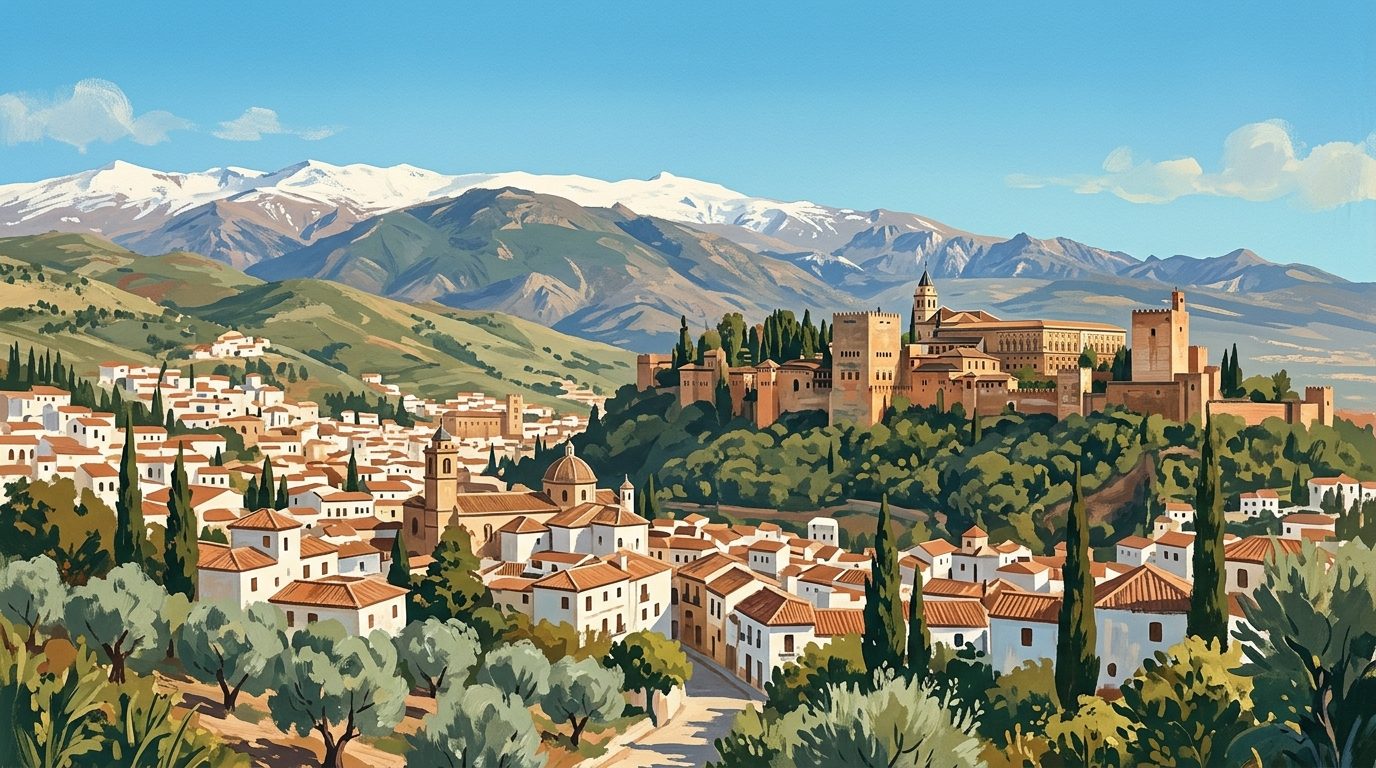
Clinging to the southern flanks of the Sierra Nevada, the Alpujarras region is geographically severe and fiercely independent. When the Catholic Monarchs took Granada in 1492, this rugged, high-altitude terrain became the final refuge for the city's fleeing Muslim population. For nearly a century, they maintained their culture, adapting Berber architectural traditions to the dramatic Andalucían topography.
Today, the physical legacy of that era remains entirely intact. You will see it in the flat clay roofs (terraos), the distinctive cylindrical chimney stacks, the covered walkways (tinaos) that bridge the narrow streets, and the intricate network of acequias, snowmelt irrigation channels that still water the terraced agricultural plots.
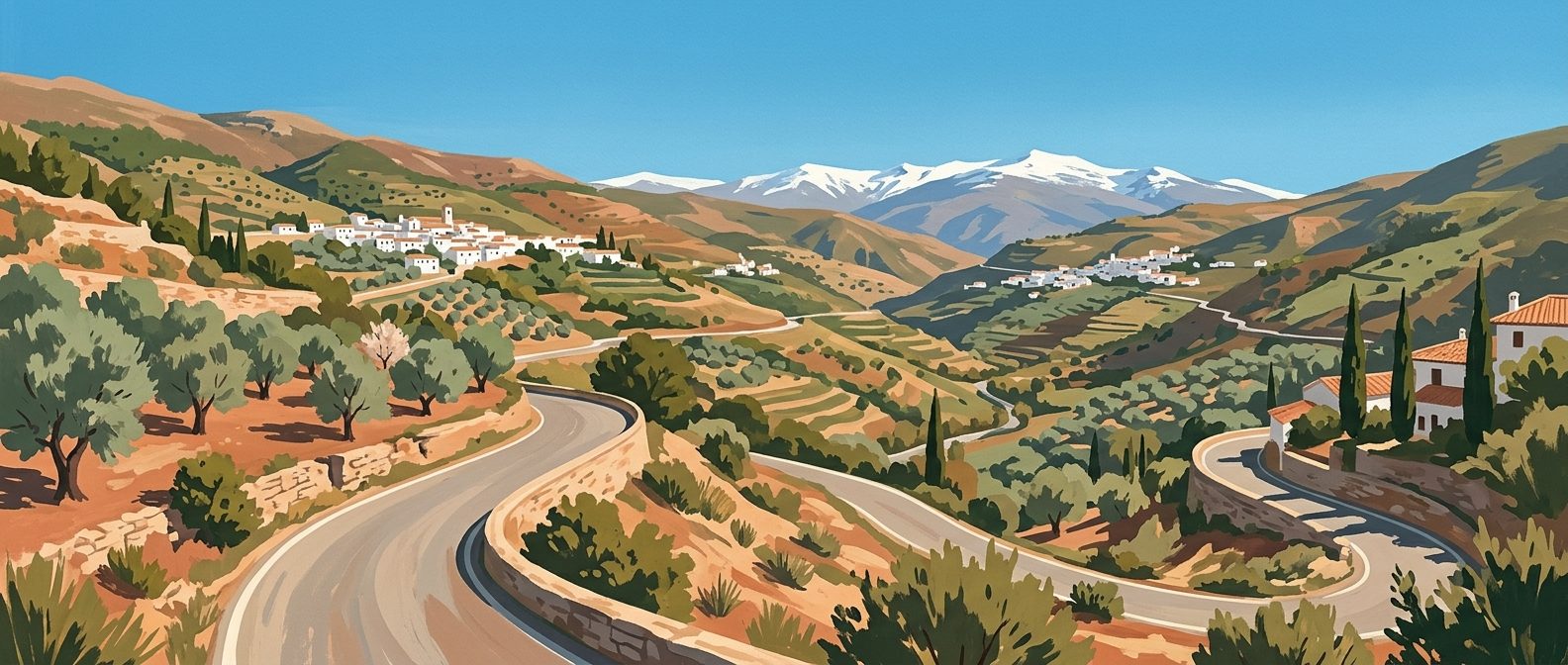
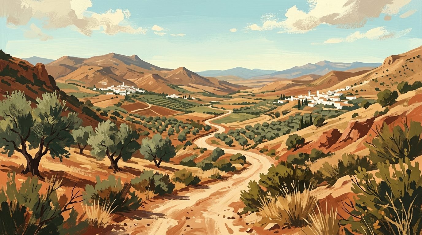
Exploring the Alpujarras requires a car, a head for heights, and patience for winding tarmac. It is not an area you can simply drive through on your way somewhere else; the roads here dictate your pace. If you are coming to hike the ancient mule paths, eat air-cured mountain ham, or scout locations for a radical change of lifestyle, understanding the layout of these valleys is essential to planning your trip.
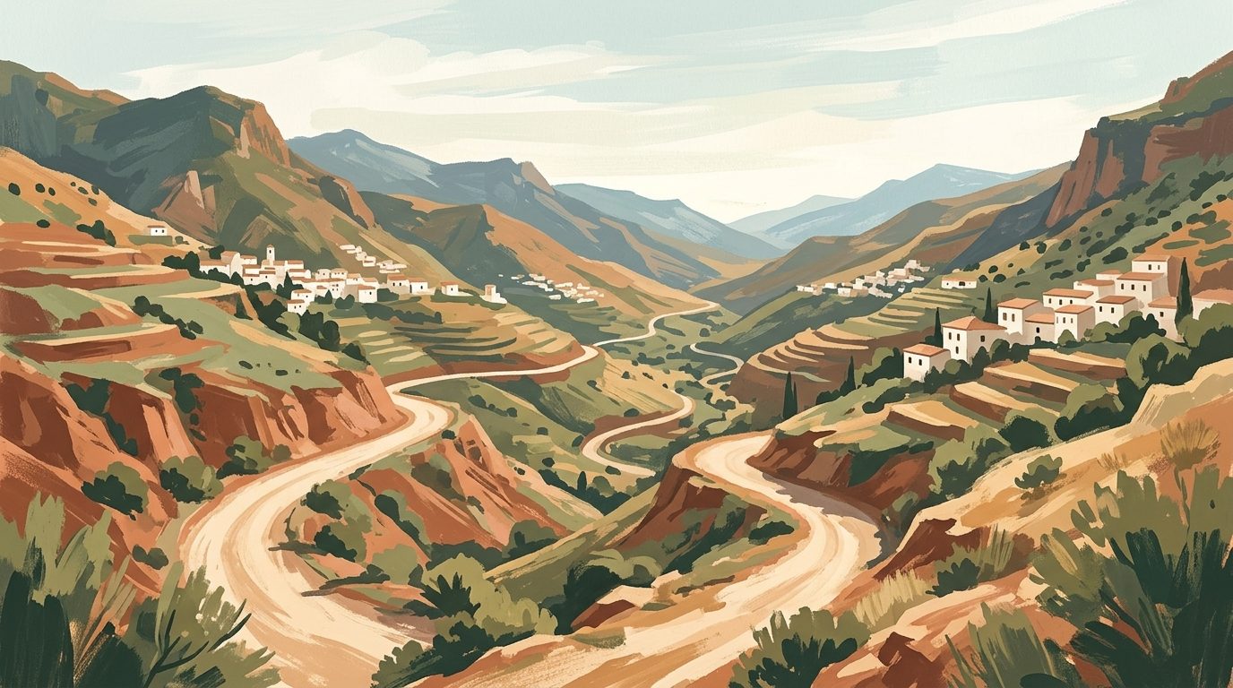
Navigating the Geography: The High and Low Alpujarras
The region is broadly divided into two zones, dictated by altitude and accessibility. The main artery is the A-348, which sweeps along the lower elevations, tracking the course of the Guadalfeo river.
The Low Alpujarras occupy this valley floor and the lower foothills. The climate here is noticeably warmer. Olive groves, citrus trees, and almond orchards dominate the landscape. The principal towns, Lanjarón and Órgiva, serve as the commercial and administrative centres.
The High Alpujarras sit much further up the mountain, accessed via the A-4132, a road consisting almost entirely of blind corners and hairpin bends. Up here, the climate is harsh in winter and remarkably cool in summer. The vegetation shifts to chestnut woods, oak forests, and alpine scrub. This is where you will find the iconic Poqueira Gorge villages (Pampaneira, Bubión, Capileira) and Trevélez, the highest municipality in the region.
The Essential Route: Village by Village
Most visitors arrive from Granada, taking the A-44 south towards the coast before turning east onto the A-348 near Lecrín. From here, the route naturally unfolds village by village.
Lanjarón: The Gateway
Your first stop on the A-348 is Lanjarón. Famous across Spain for its bottled spring water, the town feels like a slightly faded, grand European spa resort from a century ago. The main high street is long and linear, flanked by water fountains adorned with poetry by Federico García Lorca.
It is worth pulling over for an hour to walk up to the ruined Moorish castle, which balances precariously on a rock outcrop over the river valley. If you are staying the night, the historic balneario (spa) offers thermal treatments, and you can book a room at the attached hotel to break up the journey from the airport.
Órgiva: The Crossroads
Continuing 15 kilometres east brings you to Órgiva, the largest town in the region. Órgiva sits in a wide, flat basin and acts as the intersection between the coast, the high mountains, and the eastern valleys. Since the 1970s, it has been a magnet for alternative communities.
If you time your visit for a Thursday morning, the town transforms for the weekly market. The streets fill with a mix of local farmers selling seasonal produce, expats trading second-hand books, and members of the nearby Beneficio commune selling artisanal crafts. It is fascinating, entirely authentic, and incredibly busy. Park on the outskirts near the bridge over the Río Chico to avoid getting stuck in the narrow one-way system.
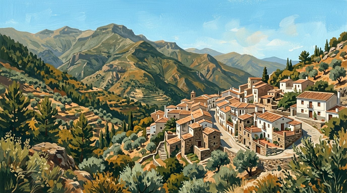
The Poqueira Gorge: Pampaneira, Bubión, and Capileira
Just past Órgiva, the A-4132 branches sharply off to the left and begins a relentless, zigzagging ascent into the High Alpujarras. This road takes you to the Poqueira Gorge, home to the three most visually striking villages in the region.
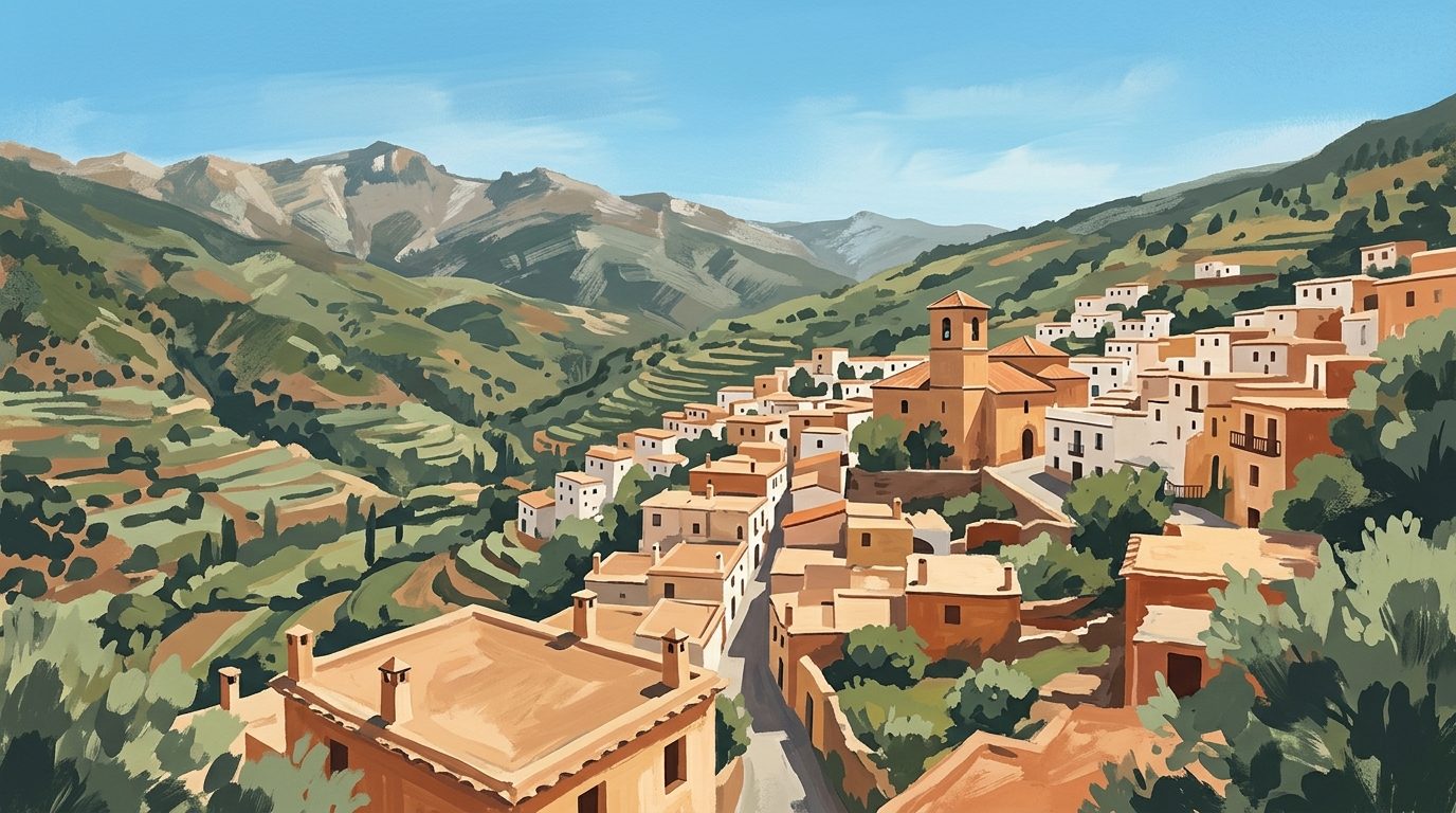
Pampaneira (1,058m) is the first village you reach. Because it is the lowest and easiest to access, it receives the heaviest foot traffic. The central plaza is dominated by the brick-built Church of the Holy Cross, and the surrounding streets are lined with shops selling colourful, locally woven jarapas (thick cotton rugs).
Bubión (1,300m) sits a few kilometres further up the road. It lacks the commercial intensity of Pampaneira, making it a vastly superior option for an overnight stay. The evenings here are intensely quiet. The village offers unencumbered views down the gorge all the way to the Mediterranean on clear days. Look for guesthouses with traditional flat roofs or consider the local rural resort for reliable heating during the colder months.
Capileira (1,436m) is the village at the end of the line. It literally sits at the edge of the road, marking the point where the tarmac ends and the serious mountain tracks begin. This is the ultimate basecamp for serious hikers. The architecture is severely traditional, and the steep, cobbled paths (callejones) require substantial physical effort just to navigate the village.
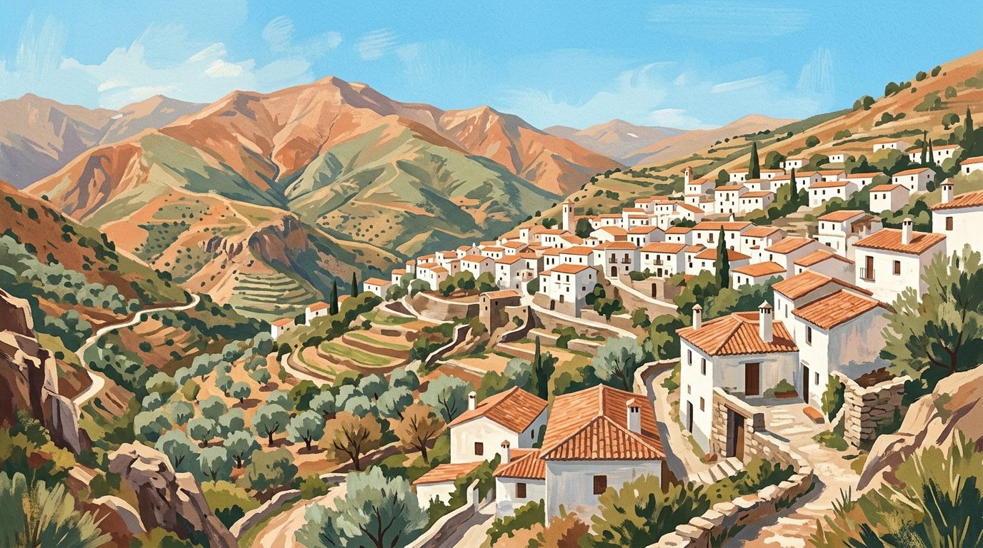
Trevélez: The High Eastern Road
If you bypass the Poqueira Gorge and continue winding eastwards on the A-4132, the road cuts through dense chestnut forests before arriving at Trevélez. Sitting at 1,476 metres, it is one of the highest settlements in Spain.
Trevélez is entirely defined by its altitude and the freezing, dry winds that sweep down from the peaks. These conditions are perfect for curing meat. As soon as you step out of your car, you will smell the distinct, sweet aroma of curing pork. The village is divided into three tiers (Barrio Alto, Medio, and Bajo). Most of the commercial drying houses (secaderos) offer brief tours and tasting sessions. Walk up to the Barrio Alto to escape the coach tours; the streets here are virtually unchanged from the 19th century.
Hiking the Alpujarras: Trails for Strong Knees
The Alpujarras is a premier destination for hiking, but the terrain is unforgiving. Trails are heavily graded, and the combination of altitude and intense southern Spanish sun requires careful planning.
Ruta de los Pueblos del Poqueira
This is the classic circular day hike. It connects Pampaneira, Bubión, and Capileira, descending to the riverbed of the Poqueira gorge and climbing back up through ancient oak forests. The trail takes roughly four hours to complete. Start early in Capileira and hike downwards to Pampaneira for a late breakfast, then tackle the steep ascent back up the opposite side of the valley before the midday heat hits. Ensure you wear proper walking boots; the descent paths are composed of loose shale and can be dangerously slippery.
The Siete Lagunas Trek
For highly experienced mountain walkers, the trail from Trevélez to the Siete Lagunas (Seven Lakes) is an exceptional, demanding route. This path climbs relentlessly from the village up into a glacial valley at 2,900 metres, sitting directly below the summit of Mulhacén. It is an eight-to-ten-hour round trip requiring extreme physical fitness. Weather conditions at the lakes can deteriorate rapidly, bringing freezing fog even in August. Never attempt this without a physical map, compass, and thermal layers. If you prefer to walk with an expert, you can hire a certified high-mountain guide.
Accessing Mulhacén
If you intend to summit Mulhacén (the highest peak in mainland Spain at 3,482m), Capileira is your logistical hub. During the summer months, the National Park authority operates a shuttle bus (the Servicio de Interpretación de Altas Cumbres) from Capileira up to the Alto del Chorrillo at 2,700m. This cuts out the most gruelling approach work, allowing you to complete the summit as a manageable day hike. You must book your bus tickets at the SIAC (Servicio de Interpretación de Altas Cumbres) information office in Capileira or via the official booking portal days in advance, as seats are strictly limited.
Food Traditions: Fuel for the Mountains
Alpujarreño cuisine was developed for people performing backbreaking agricultural labour in freezing temperatures. It is highly caloric, unpretentious, and exceptionally satisfying after a long day on the trails.
The definitive regional order is the Plato Alpujarreño. You will find it on every menu from Lanjarón to Yegen. It consists of poor-man's potatoes (patatas a lo pobre, slow-fried with onions and green peppers), fried eggs, a thick slice of Trevélez jamón, morcilla (blood sausage), and longaniza (a local spiced sausage). It is heavy, greasy in the best possible way, and will put you straight to sleep.
Another staple is migas, toasted breadcrumbs or semolina flour fried with garlic and served with chunks of pork belly and melon. To drink, ask for the local vino costa. Produced in the Contraviesa mountain range directly to the south, this is a robust, slightly cloudy rosé wine traditionally poured straight from the barrel.
Considering Rural Living: The Reality of the Mountains
The Alpujarras has drawn expatriates and writers for over a century, most notably Gerald Brenan, who documented his life in the remote eastern village of Yegen in the 1920s. Today, many visitors arrive on a week-long holiday and begin idly checking estate agent windows.
If you are considering rural living here, you need to look past the romantic ideal. Life in these mountains requires genuine resilience. Many of the traditional stone houses (cortijos) are incredibly difficult and expensive to heat during the long winters. Maintaining an agricultural property means understanding and adhering to the complex, centuries-old community rules governing the acequia water distribution.
Legally, purchasing a rural property in Andalucía is fraught with complications regarding illegal builds. You must ensure any country property has an AFO certificate (Asimilado a Fuera de Ordenación), which regularises its status and guarantees access to basic services. Finally, consider isolation. While the community is tight-knit, the physical distance to major hospitals in Motril or Granada can be a serious logistical issue as you age. Spend at least two consecutive months renting in the dead of winter before committing to a purchase.
Practical Information
When to Go: The optimal windows for visiting are mid-April to early June, and late September to November. Spring brings the cherry blossoms and roaring rivers fed by snowmelt. Autumn provides spectacular foliage as the chestnut trees turn gold. Summer (July and August) is punishingly hot in the lower valleys, though the High Alpujarras remain tolerable. Winter brings snow, which frequently closes the roads above Capileira and Trevélez.
Getting Around: While the ALSA bus company runs a daily service from Granada (currently three times daily as of summer 2026; check the official ALSA timetable before travelling) to the Poqueira Gorge (taking roughly 2.5 hours), relying on public transport severely limits your mobility. Renting a car in Granada or Málaga is highly recommended.
Driving Caveats: The A-4132 demands your full attention. The road is narrow, often lacks guardrails, and locals drive it much faster than you will feel comfortable doing. Pull over where safe to let them pass. If you or your passengers suffer from motion sickness, take medication at least an hour before turning off the A-348. Thirty kilometres on these roads will easily take over an hour of driving time.
What to Bring: Regardless of the season, bring warm layers. The temperature differential between the midday sun and the evening shade at 1,400 metres is drastic. If you plan to walk beyond the village limits, sturdy, ankle-supporting walking boots and a refillable water bottle are mandatory.
Last reviewed: 21 June 2026 · Editorial policy
Related guides
Güéjar Sierra: A Gateway to the High Sierra Nevada
Discover Güéjar Sierra, a rugged mountain village in the Sierra Nevada that serves as the ultimate base for hiking the Vereda de la Estrella and exploring the historic tramway route.
6 min read
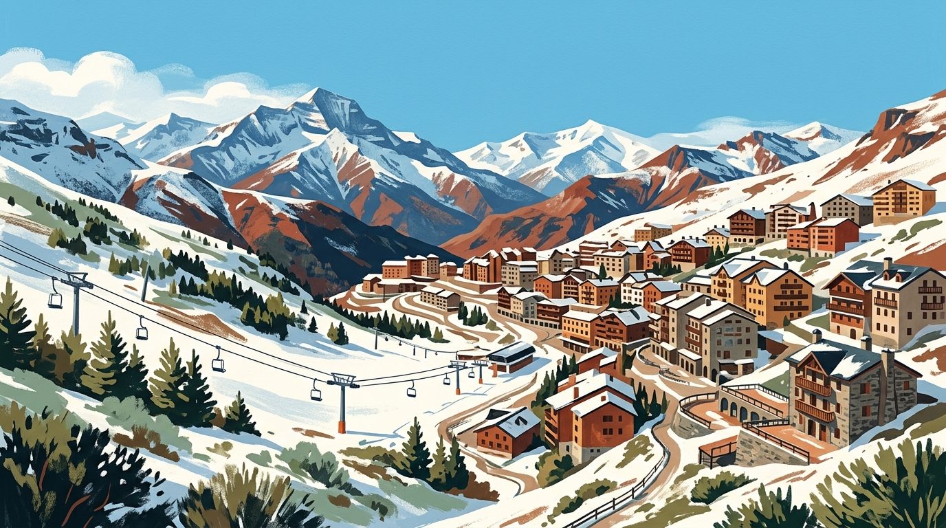
A Guide to Pradollano: Skiing and Summer in the Sierra Nevada
Discover Pradollano, the sun-soaked hub of the Sierra Nevada ski resort, offering 110km of pistes and stunning high-altitude summer hiking.
6 min read
High Altitudes and Berber Roots: A Local Guide to the Alpujarra Granadina
Discover the high-altitude white villages of the Alpujarra Granadina, where Berber history meets mountain tradition in the shadows of the Sierra Nevada.
10 min read
High Altitudes and Deep Valleys: A Local's Guide to the Sierra Nevada
Explore the roof of Spain with our insider guide to the Sierra Nevada, from the sun-soaked slopes of Pradollano to the traditional mountain trails of Güéjar Sierra.
6 min read
Granada and the Alpujarras: A 5-Day Loop
Combine the architectural majesty of the Nasrid kings with the high-altitude solitude of the Sierra Nevada's southern slopes. This five-day loop transitions from urban tapas culture to the rugged traditions of Spain’s highest white villages.
8 min read
Exploring Capileira: The Roof of the Alpujarra
Perched at 1,436 metres in the Sierra Nevada, Capileira is the ultimate base for exploring the Alpujarra's white villages and conquering the peaks of Mulhacén.
6 min read
More from Granada
Sierra Nevada Skiing Guide: Southern Spain's High-Altitude Pistes
Skiing in the <a href="/granada/sierra-nevada" class="internal-link">Sierra Nevada</a> offers an experience unparalleled in Europe: carving down sun-drenched pistes at 3,000 metres before driving down to the coast for an afternoon on the beach. Here are the best strategies for navigating the peaks of <a href="/granada/sierra-nevada/pradollano" class="internal-link">Pradollano</a>, avoiding the weekend bottlenecks, and finding the quietest red runs above <a href="/granada" class="internal-link">Granada</a>.
9 min read
Walking the Camino Mozárabe: The Complete Guide from Granada to Córdoba
The Camino Mozárabe traces one of the oldest and quietest pilgrimage routes in Spain, swapping crowded northern trails for endless Andalucían olive groves and sheer-sided ravines. Walking from Granada to Córdoba requires stamina and preparation, but rewards solitary walkers with an unfiltered immersion into rural southern Spain.
10 min read
Newsletter
More stories from Andalucía
Weekly notes, seasonal picks, and the next guides worth bookmarking.